


Since the Federal Aviation Administration began regulating drones in 2016, drone technologies have become essential. Portable drones have redefined aerial home photography, allowing real estate agents to promote beautiful, unique, or unusual properties with updated drone technology.
Drone photography is also more efficient and accessible than hiring a helicopter—naturally! A pilot flies their camera over the property with drones, taking high-quality photos and recording drone views of your house and the surrounding landscape. These photos boost real estate listings significantly. Read on to learn how to use drone photography for real estate marketing.
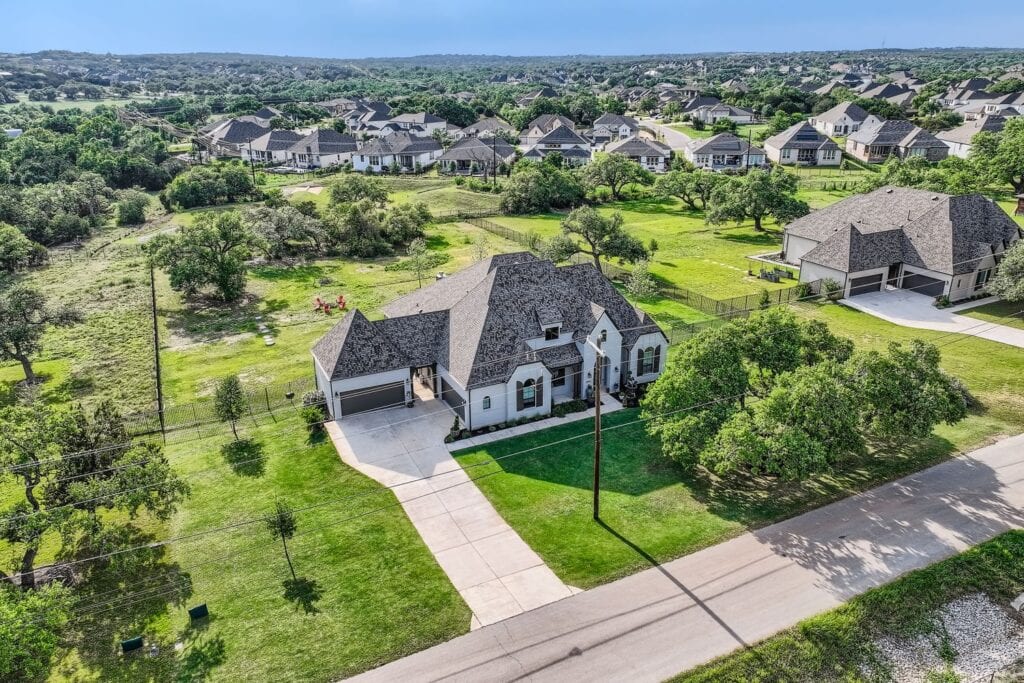
How drone photography sells real estate
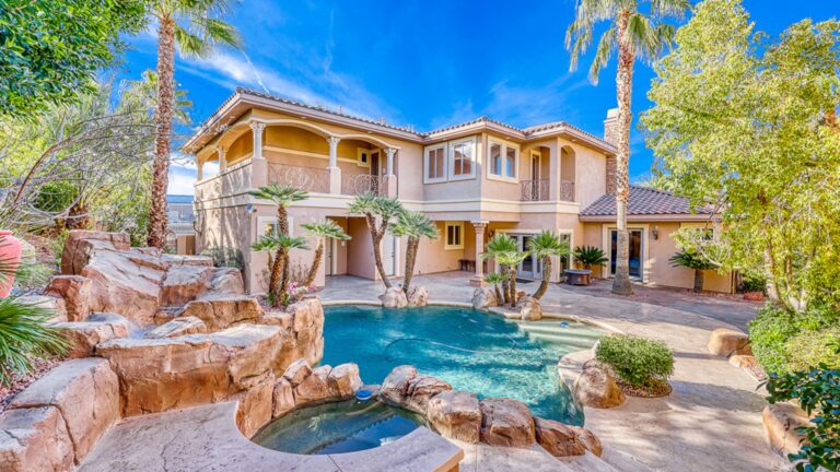
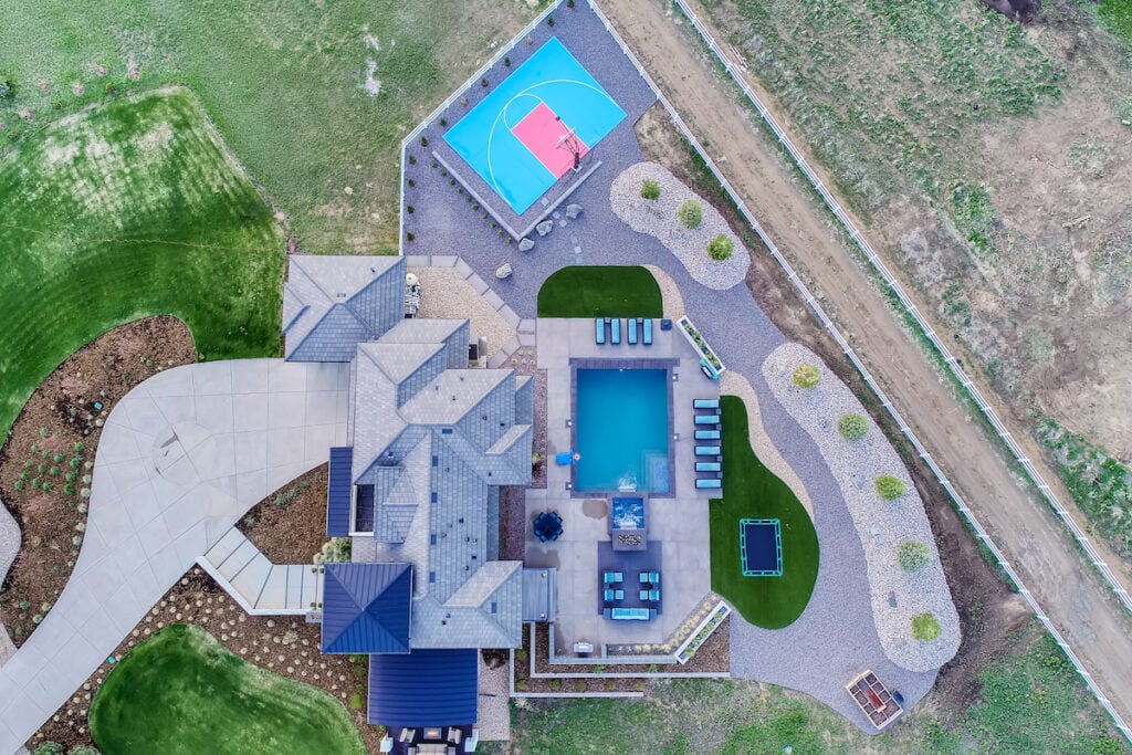
How do drones improve real estate marketing? Utilizing a striking perspective sells and rents properties 68% faster by capturing immediate buyer interest and providing comprehensive visual information. Aerial photography gives potential home buyers a stronger sense of the scale of the entire property and a clear representation of the topography.
Real estate drone photography can evoke a mood of what it will feel like when the potential buyer moves in. Whether it’s residential or commercial property, these aerial shots work well for
- large plots,
- capturing breathtaking views,
- showcasing location to surrounding amenities, or
- unique property features.
Visually showing the property’s vastness is better than a description of it. Aerials are even excellent for showing the roof or solar arrays, making it easier for prospective buyers to make a decision.
Essential tips for real estate aerial photography
Many traditional photography tips still apply to the drone photographs. You need to pay attention to weather and lighting to get the best results.
Take advantage of natural light
Professional real estate photographers prefer natural light. While shooting at noon gives the shortest shadows, drone accessories like Neutral-Density (ND) filters are now essential to cut glare and manage harsh exposure. You can also shoot during “Golden Hour” to avoid harsh light, though early morning is excellent for capturing quiet surrounding streets.
Wide-angle shots and a variety of shots
Wide-angle shots are best to capture the view, but you must also consider what equipment you need? Modern drones with high-resolution sensors and gimbal stabilization allow for low-altitude, detailed shots of landscaping that mix well with high-altitude “roof-only” shots.
Guidelines for using real estate drone photography
Do you need a drone license to fly a drone? The answer is a resounding, yes!
For any commercial real estate use, you must hire a pilot with an FAA Part 107 Remote Pilot Certificate. This ensures they have passed the latest Aeronautical Knowledge Test and understand current safety protocols.
Are there any legal considerations for aerial drone filming?
Absolutely. As of 2026, there are several critical legal considerations when filming with drones:
- Remote ID: Almost all drones must now broadcast a digital signal (Remote ID) identifying their location.
- Restricted Airspace for Drones: Pilots must use Low Altitude Authorization and Notification Capability (LAANC) to get instant authorization before flying in controlled zones near airports.
- Altitude & Speed: Drones must stay below 400 ft and cannot exceed 100 mph.
- Privacy: Pilots must be aware of local privacy ordinances when capturing footage near neighboring homes.
Using drone photography for real estate marketing
Adding stunning aerial views to a property listing helps bring it to life. Here at Virtuance, we’re setting a new standard in real estate marketing with our top-of-the-line aerial photography and video for real estate. With over 85% of homebuyers now expecting to see aerial visuals online, your listing needs to grab their attention right away.
Generate more clicks that turn into showings and solid offers with dramatic aerial photography. Your images will show the home along with the entire property, surrounding neighborhood, and views.
Schedule your shoot and add an aerial package today to boost your property listings.