


As the 2026 market continues to find its footing amidst shifting inventory levels, it doesn’t mean you can’t succeed. Where digital-first browsing is the absolute standard today, offering high-end, immersive real estate photography is no longer a luxury—it is the most effective way to capture buyer attention and drive success this year.
While traditional real estate photos are great, you may be asking yourself, “How do I get an aerial view of my property?“
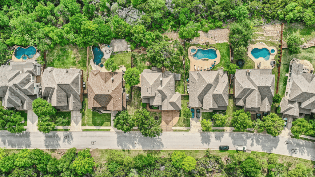
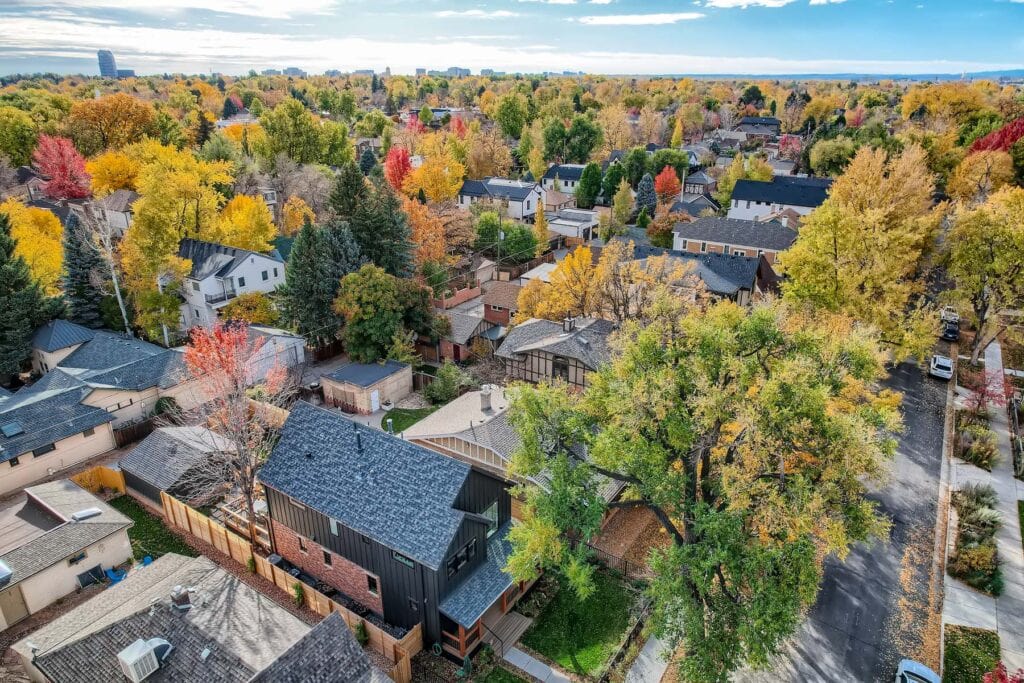
An aerial view of the house and property lets potential buyers better understand the layout of your property. This article will explore how you can get aerial imagery of your property to avoid missing any sales opportunities.
Benefits of including an aerial view of a house
One of the most significant benefits of using an aerial view of a property is that the images stand out from the competition.
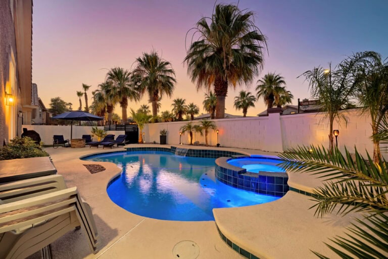
Standard indoor photos are great, but they may not let buyers get a lay of the land, especially if the property has unique outdoor features or a new roof. As a result, these properties are more likely to sell quickly when aerial photography is used.
The flexibility of aerial photography allows sellers to control how their images are framed, visually speaking. Depending on what type of mood you wish to convey, aerial photography offers many options that traditional photography cannot.
How to get an aerial view of property
If you’re wondering, “How do I find an aerial view of my house with property lines?”, we have you covered!
There are two easy ways to get an aerial view of your property: professional real estate photography and drone imagery or satellite services.
Professional real estate photography
The easiest way to enjoy the benefits of aerial photography is by using a drone or hiring a drone operator to come to your property.
At Virtuance, we offer aerial video and aerial image packages so that you don’t have to rely on a grainy satellite photo or Google Maps to show property lines.
If you want to use the images in a listing, going with professional real estate photos and drone images will ensure your property shines.
Satellite services
There are more than 18,000 satellites currently orbiting Earth. An easy way to access free satellite images of your property is with Google Earth.
That said, your images may be grainy and not ideal for a listing.
While there are other satellite services available, such as the NOAA’s Geostationary Operational Environmental Satellites, you can’t center in on a specific property. If you tried to see your house from space in these images, you’d be lucky to find a speck!
Aerial drone imagery with Virtuance
While not every property requires aerial photography, aerial mages allow potential buyers to understand better how the property line looks relative to the facilities.
Drone photography has made it easier than ever to take high-resolution images from any angle above your home. The aerial views can set your home apart from the competition.
Around 96% of homebuyers make their purchasing decisions online. Let the experts at Virtuance serve your listing needs. Choose one of our online packages today to start the process.