


Key Takeaways
- Commercial drone use for real estate requires an FAA Part 107 license, even for “free” photos taken by an agent.
- The FAA retired the standalone B4UFLY app, so agents must now use approved third-party apps like Air Aware (Aloft) to check airspace.
- Hiring a certified professional, like Virtuance, protects agents from steep federal fines and liability associated with unauthorized drone flights.
Unauthorized drone flights can lead to heavy FAA fines and significant legal liability for real estate professionals. Checking airspace before a shoot ensures your marketing remains compliant and your brand stays protected. This guide explains how to identify restricted zones and why professional certification is non-negotiable.
Do you need a drone license to fly a drone for real estate?
Many agents wonder if they can fly a drone themselves without a license if they aren’t charging for the service. The answer is a definitive no. The Federal Aviation Administration (FAA) classifies any flight that furthers a business—including listing a home—as commercial work.
To fly legally for real estate, you must hold a Remote Pilot Certificate under FAA Part 107. Recreational rules (Section 44809) only apply to flying purely for fun. Using a “hobbyist” drone for a listing without a Part 107 license is a federal violation. This requirement remains the same whether you are a solo agent or part of a large brokerage.
How can I find no-fly zones in my area for drone flying?
When getting an aerial view of your property, checking for restricted airspace for drones is simpler than it used to be. While the original B4UFLY app is retired, the FAA now partners with third-party providers to deliver real-time data.
To see a map of restricted airspace, download one of these FAA-approved apps:
These apps use a color-coded system to show where you can and cannot fly.
- Red Zones: A red zone usually indicates a permanent No-Fly Zone, such as a military base or national park.
- Yellow/Orange Zones: Yellow or orange zones typically represent controlled airspace near airports.
In these areas, you may need a LAANC (Low Altitude Authorization and Notification Capability) authorization before taking off. LAANC auto-approves drone pilots’ access to controlled airspace under 400 feet while providing real-time updates on flight restrictions and ensuring air traffic professionals have visibility into local drone operations.
Are there laws about flying drones over private property?
A common question from homeowners and agents is: can someone fly a drone over your property? Under federal law, the FAA governs all navigable airspace. This means drone pilots can legally fly over private land as long as they follow Part 107 or recreational safety rules.
However, state and local laws regarding privacy and “aerial trespass” still apply. You should never hover low over a neighbor’s backyard or record through windows. To maintain professional ethics, always notify neighbors of drone shoots and keep the flight path focused strictly on the listing.
How to check if your listing is in a no-fly zone
Before scheduling your aerial photography, use this “No-Fly Zone Checklist” to verify compliance:
- Download an FAA-Approved App: Use Air Aware (Aloft), AutoPylot, or UASidekick to view a restricted airspace map.
- Search the Property Address: Enter the listing’s exact address to see local flight restrictions.
- Check for TFRs: Look for Temporary Flight Restrictions (TFRs) caused by sporting events, VIP movement, or wildfires.
- Verify Airspace Class: Identify if the listing is in Class B, C, D, or E controlled airspace.
- Check LAANC Availability: See if the app allows for “Auto-Approval” for flights at specific altitudes in that area.
- Review Local Ordinances: Check if the city or HOA has specific rules about drone takeoff and landing on public property.
Why hiring a certified professional protects your brokerage
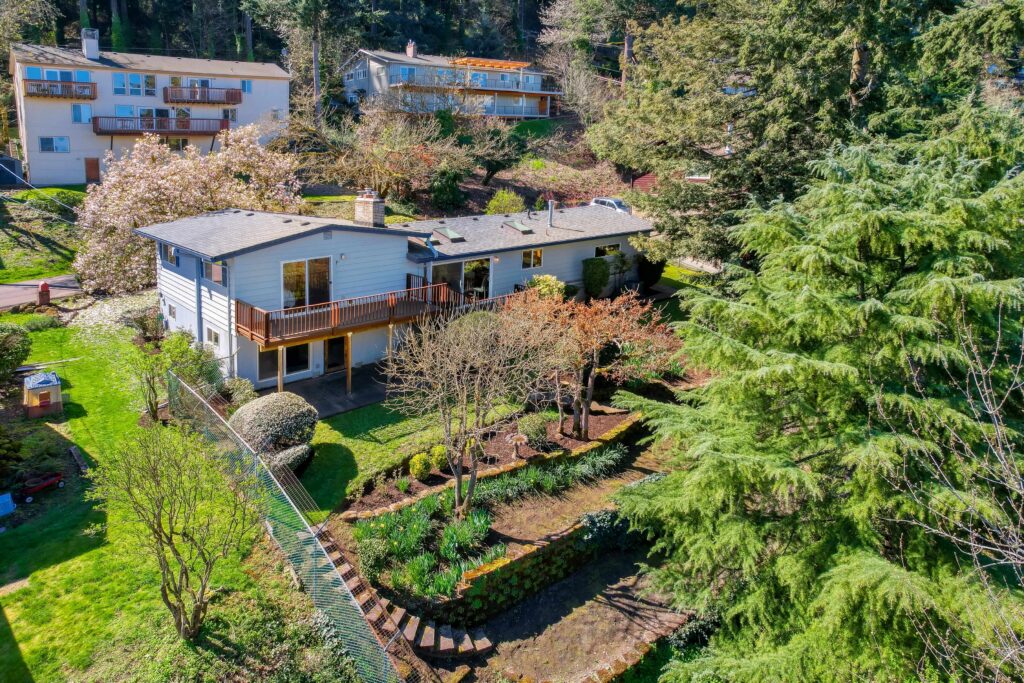
If an unlicensed pilot crashes or flies in restricted airspace, the FAA may hold the agent or broker liable for hiring them. Professional real estate photographers, like those at Virtuance, carry Part 107 certification and comprehensive insurance.
Our team handles the technical side of real estate drone laws and FAA compliance. Our photographers check every address for flight restrictions before the shoot begins. This proactive approach ensures your aerial imagery is captured safely and legally, removing the burden of liability from your shoulders.
Final thoughts on airspace safety
Navigating the skies requires more than just a drone; it requires an understanding of federal law and safety protocols. By using the right tools to check for no-fly zones, you protect your professional reputation and your clients. Partnering with experts ensures that your high-end marketing never comes at the cost of legal complications.
Experience the Virtuance difference
Virtuance provides FAA-compliant, fully insured drone photographers who specialize in capturing stunning aerial perspectives. Our team meticulously checks all flight restrictions and handles LAANC authorizations to ensure your listing is showcased safely and legally.
New clients can use code NEWCLIENT50 to receive $50 off their first order. Schedule your aerial shoot today and see why top agents trust Virtuance for their media needs.
FAQ
Do I need a license to fly a drone for my own real estate listings?
Yes, the FAA requires a Part 107 Remote Pilot Certificate for any drone flight that promotes a business or listing.
What is a no fly zone for drones?
A No-Fly Zone is a specific area where drone flight is prohibited due to safety, security, or privacy concerns, such as near airports or military bases.
Can you fly through restricted airspace with a drone?
You can only fly in controlled or restricted airspace if you receive a LAANC authorization or an official FAA waiver.
How do I know if my drone flight is legal?
A flight is legal if the pilot is Part 107 certified, the drone is registered, and the airspace has been cleared via an FAA-approved app.
Where can I see a map of restricted airspace?
You can view a restricted airspace map using FAA-approved apps like Air Aware (Aloft) or the FAA’s Visualize it tool online.